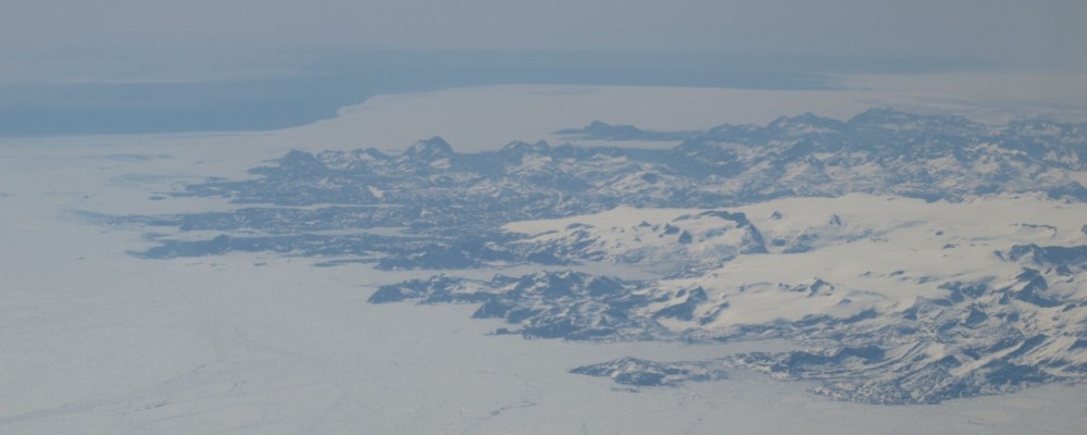
More Challenging Than the South and Covers Both Weather and Ice Few countries have such a large span in their forecasting as Denmark. The mainland is localised around 55 degrees north, but the forecasting also includes Greenland with large oceans and land areas mainly north of the Arctic Circle. Many people along the coast of […]
The Weather from Space – Meteorological Satellites Celebrate Sixty Years
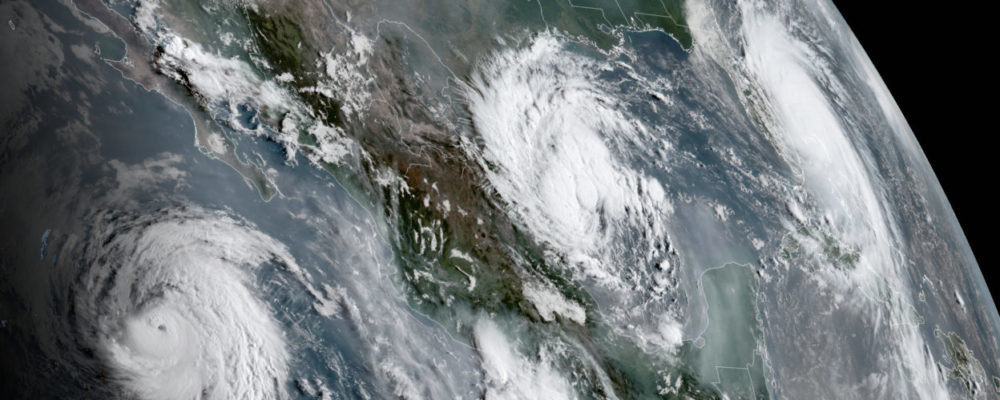
Sixty years ago, meteorologist for the first time could see the Earth’s weather systems from observatories high above the clouds. The world’s first meteorologically satellite, the American TIROS, from a height of more than six hundred kilometres above the Earth could follow the development of the cloud systems and their movements above Earth. TIROS -1, […]
MATS – New Scientific Satellite from Sweden
For the past two decades, Sweden has continuously developed and built their own scientific satellites – and the next in line, MATS, is now ready for launch. MATS is the next in a series of satellites that include Viking, Freja, Astrid 1 and 2, Odin and Prisma, all national initiatives, although some are built together […]
Very High Tide on the Norwegian Coast
The combination of low air pressure, full moon and strong wind gave in January and February very high tide along the Norwegian coast. Some areas had a tide around one metre over the normal high tide. Luckily the storms been weaker than the warn and the damages been not so comprehensive as feared. But […]
Radar Pictures at One – Two – Three
Cooperation between the Finnish ICEYE and the Norwegian KSAT it will be possible to deliver complete SAR images to the customer within fifteen minutes after the satellite has taken the pictures. Through two decades of acquisition of radar pictures from space, the customers have had the possibility to detect details on earth every time, […]
Satellites Needed in Modern Shipping.
Shipping has almost always been a key factor in terms of being able to sell and buy goods, so all types of trade have depended heavily on shipping opportunities, firstly on a local basis, gradually for markets father away, and eventually globalisation has proved dependent on shipping access internationally. Navigation across oceans was firstly […]
Rymdforum 2019 – Meeting Place for the Swedish Space Community
Despite many interesting topics and news at the forum, the most interesting topic was without a doubt the Swedish Space Community’s plan to develop Esrange intended to launch small satellites within the next few years, and the new trend in terms of both small satellites and small launchers.
Swedish Institute of Space Physics – Fifty Year in Space and Still Holding the Lead
October 3, 1968, the first instrument, developed and built at The Swedish Institute of Space Physics (Institutet för rymdfysik, IRF) was launched onboard the European satellite ESRO–1A. Fifty-one years later the first Swedish instrument landed at the Moon’s far side, as a part of the Chinese Chang’E-4 spacecraft. The first instrument, named S71B could […]
Broadband for the Arctic From 2023
Norway’s Intention to Build and Operate Communication Systems for the Artic Areas Warmer climate and a desire to utilise natural resources, has led to an increased activity in the Arctic and the near Arctic areas, and similarly, the need for adequate communication has also increased. Today the communication systems are not the best. […]
Grand Challenge Initiative – Rocket Campaign at Andøya Space Center
Two sounding rockets from NASA blasted off from the rocket range at Andøya early in December 2018, marking the beginning of one of the largest campaigns ever from the rocket range in the northern Norway. The campaign named “Grand Challenge Initiative” is designed to explore the area called the Geomagnetic Cusp, or Polar […]